Lake Tahoe Marathon
Lake Tahoe, United States of America · Sunday 17 January 2027
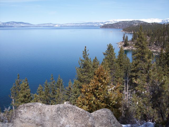
The marathon course covers the mountainous western shore of Lake Tahoe, starting on Highway 89 near Homewood, California, and finishing at Lakeside Beach in South Lake Tahoe. Runners experience an immediate challenge with the course's high elevation, beginning above 6,000 feet and reaching a maximum elevation of about 6,838 feet, with the lowest point around 6,185 feet. Over the race, participants encounter about 1,785 feet of total elevation gain and nearly the same in descent.
Difficulty Calculator
h
:m
:s
Adjusted Time
4:38:17
Time difference: +38.3 minutes compared to a flat, road, temperate course.
Course Details
Elevation Gain544m
Elevation High2084m
Elevation Low1885m
Weather Forecast
High2°C
Low-1°C
Chance of Rain0%
How hard is Lake Tahoe Marathon?
Very Difficultharder than 89% of marathons
Flattest / easiestHardest
On our difficulty model, Lake Tahoe Marathon plays about 37 minutes slower than an average road marathon for a 3:30 runner. It ranks #125 hardest of 1150 marathons we analyse, and #63 of 575 in United States of America. Use the calculator above to see the exact adjusted time for your own goal pace.
What will you run at Lake Tahoe Marathon?
Estimated finish times on this course versus the same effort on an average road marathon, based on its elevation, surface, and expected race-day temperature.
| Average-course time | On Lake Tahoe Marathon | Difference |
|---|---|---|
| 3:00:00 | 3:26:40 | +26:40 |
| 3:30:00 | 4:02:18 | +32:18 |
| 4:00:00 | 4:38:17 | +38:17 |
| 4:30:00 | 5:14:37 | +44:37 |
| 5:00:00 | 5:51:17 | +51:17 |
| 5:30:00 | 6:28:17 | +58:17 |
| 6:00:00 | 7:05:37 | +1:05:37 |
Use the calculator above for your exact goal time. Want a prediction from your own training? Try the marathon time predictor.
Lake Tahoe Marathon 2027 Course Analysis
Lake Tahoe Marathon is a full marathon held in Lake Tahoe, United States of America. It is scheduled for Sunday 17 January 2027. The course is run on mixed surface with 544m of total climbing, with its high point near 2084m above sea level. For registration and full race details, visit the official Lake Tahoe Marathon website.
Elevation Profile
This is a hilly course with 544m of total climbing, rising to around 2084m above sea level. It pays to train on hills and to pace the climbs conservatively.
Expected Race Day Weather
Based on historical weather data for January, the expected race day conditions are as follows. Cold conditions are expected, with temperatures between -1°C and 2°C. While cold weather reduces overheating risk, runners should dress in layers and be prepared for potential wind chill. There is a low chance of rain (0%), so dry conditions are likely.
Surface Type: Mixed
Lake Tahoe Marathon features a mixed-surface course, combining sections of road with unpaved terrain such as gravel paths, parkland, or boardwalks. Mixed courses add variety but also introduce some unpredictability in footing. Expect slightly slower times than on a pure road course, and road-trail hybrid shoes may be the best footwear option.
Looking for an easier marathon or a tougher challenge? You can also compare Lake Tahoe Marathon against other marathons to find the right race for your goals.
Marathons of similar difficulty
If Lake Tahoe Marathon fits your goal, these courses play out about the same on our difficulty model.
Other Marathons in United States of America
Palm Beaches Marathon
West Palm Beach, United States of America
Road27m gainJuly 2026
Louisville Marathon
Louisville, United States of America
Road293m gainJuly 2026
Gone Loco Marathon
Athens, United States of America
Road0m gainJuly 2026
Dances with Dirt Marathon - Devils Lake
Baraboo, United States of America
Road0m gainJuly 2026
Austin Solstice Circuit Marathon
Austin, United States of America
Trail422m gainJuly 2026